He discussed the use of artificial intelligence and machine learning to label and interpret pictures taken from space.
One part of the discussion included the philosophy behind the types of pictures being taken. While some might look at higher resolution as a way of gathering clearer and more detailed photos, BlackSky’s approach involves getting as many opportunities to take pictures as possible to track changes. This allows for more data interpretation across time frames.
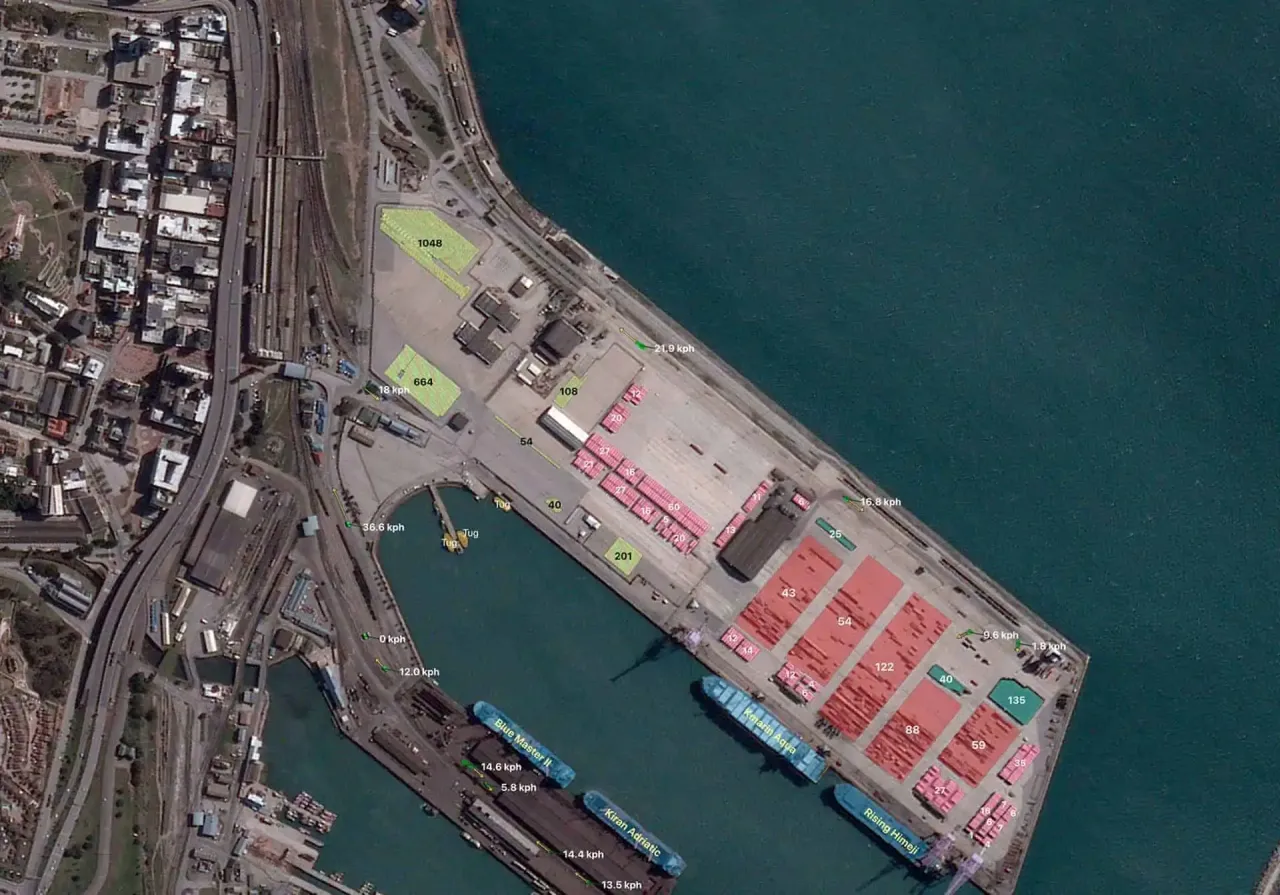
Once these pictures are uploaded, BlackSky uses artificial intelligence and machine learning software to label and count items in the space. For example, when taking pictures of an airport, the algorithm will show how many planes are on the ground and where they are located. Over time, this can provide data on how busy an airport is and the distribution of aircraft traffic.
Other use-cases of this technology include characterizing global commodity dynamics at ports, infrastructure and construction process monitoring, or even the movement of people during a crisis.
Matt noted that the biggest difficulty to getting good information from the pictures is cloud cover. “We lose half of our collection attempts to clouds.” Most pictures are taken between 10 am and 2 pm local time to get the best lighting. However, no matter how bright the sun is shining in space, cloud cover can ruin a picture.
One of the questions posed by students was around the regulations for where companies like BlackSky are not allowed to photograph. The answer surprised the students. Matt noted that most of the geospatial regulations actually involve photographs taken at much higher resolution levels. The resolution used by BlackSky is not high enough to be forbidden from taking pictures anywhere.
At the end of the conversation, Matt Dykstra talked to students about how many different disciplines are used to make all this possible. He highlighted the need for new perspectives and a variety of information to create the AI/ML interface and make sure that everything works as it should. From satellite function to the viability of the work being produced, students got a better idea of how the geospatial imaging and data industry functions and how it is used throughout the world.
Our next guest for our Air & Space Community Conversation series will be Kate Kelly of BWX Technologies on Monday, October 18!